
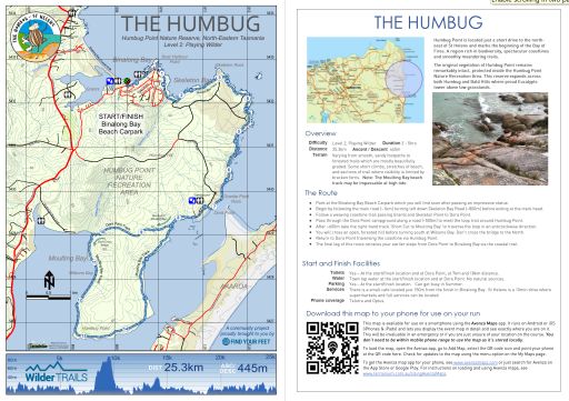
THE HUMBUG
Everywhere I look there are hulking red, red rocks and boulders, their rich hues contrasted to absolute perfection by the pure blue of the waters of the Tasman Sea and the cloudless skies, which meet on the horizon and stretch to forever. Disappointment is not an option. - The Australian Traveller
|
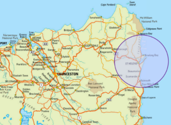
Humbug Point is located just a short drive to the north-east of St Helens and marks the beginning of the Bay of Fires. A region rich in biodiversity, spectacular coastlines and smoothly meandering trails.
The original vegetation of Humbug Point remains remarkably intact, protected inside the Humbug Point Nature Recreation Area. This reserve expands across both Humbug and Bald Hills where proud Eucalypts tower above low grasslands. |
|
Overview
Difficulty Level 2, Playing Wilder Duration 3 - 5hrs Distance 25.3km Ascent / Descent 445m Terrain Varying from smooth, sandy footpaths to forested trails which are mostly beautifully graded. Some short climbs, stretches of beach, and sections of trail where visibility is limited by bracken ferns. Note: The Moulting Bay beach track may be impassable at high tide. |

|
* Warning this route is tidal and we suggest doing it at low tide as the Dora Point beach section can be impassable at high tide. Try to avoid passing through areas above the beach as they are highly sensitive cultural areas & home to many nesting birds.*
The Route
The Route
- Park at the Binalong Bay Beach Carpark which you will find soon after passing an impressive statue.
- Begin by following the main road (~1km) turning left down Skeleton Bay Road (~800m) before exiting at the track head.
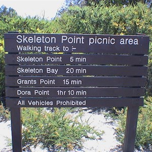
- Follow a weaving coastline trail passing Grants and Skeleton Point to Dora Point.
- Pass through the Dora Point campground along a road (~500m) to meet the loop trail around Humbug Point.
- After ~600m take the right-hand track 'Short Cut to Moulting Bay' to traverse the loop in an anticlockwise direction.
- You will cross an open, forested hill before turning south at Wilsons Bay. Don’t cross the bridge to the North.
- Return to Dora Point traversing the coastline via Humbug Point.
- The final leg of this route retraces your earlier steps from Dora Point to Binalong Bay via the coastal trail.
Start and Finish Facilities
Toilets Yes – At the start/finish location and at Dora Point, at 7km and 18km distance.
Water Town tap water at the start/finish location and at Dora Point. No natural sources.
Parking Yes – At the start/finish location. Can get busy in Summer.
Services There is a small cafe located just 150m from the finish in Binalong Bay. St Helens is a 10min drive where supermarkets and full services can be located.
Phone coverage Telstra and Optus.
|
Mapping & directions for this route
We have created 4 easy ways for you to choose from to safely and enjoyably navigate your way around this route. From a physical map to the more technology savvy, we have your safety at heart!
|
Here is a sample of the mapping and directions available as a PDF download or printed waterproof versions
|

FREE TO DOWNLOAD
|
Digitally interactive map for use on your smartphone (FREE)
This map is available for use on a smartphone using the Avenza Maps app. It runs on Android or iOS (iPhones & iPads) and lets you display the route map in detail and see exactly where you are on it. This will be invaluable in an emergency or if you are just unsure of your location on the course. You don’t need to be within mobile phone range to use the map as it’s stored locally. To load the map, open the Avenza app, go to Add Map, select the QR code icon and point your phone at the QR code here. To get the Avenza map app for your phone, see www.avenzamaps.com or just search for Avenza on the App Store or Google Play. For instructions on loading and using Avenza maps, see www.terrainium.com.au/UsingAvenzaMaps |
Concluded the route? Don't forget to get your completion badge or lapel pin!
Humbug Point is located just a short drive to the north-east of St Helens and marks the beginning of the Bay of Fires. A region rich in biodiversity, spectacular coastlines and smoothly meandering trails, we feel it is one of the undiscovered trail running gems of Tasmania.
The Humbug route begins in Binalong Bay and follows a weaving coastline trail to Dora Point and the gaping mouth of George's Bay, a narrow inlet which opens into the frequently roaring Tasman Sea. From here you will pass through the Dora Point campground to meet the loop trail around Humbug Point, traversing the loop in an anticlockwise direction. The loop first takes you over an open, dry sclerophyll forested hill to Moulting Bay where pelicans and water birds rest in the calm shallows. The return to Dora Point traverses the coastline to Humbug Point and then through spectacular grass tree forests whilst the distant ocean beaches may be roaring on a wilder day. The final leg of this route retraces your earlier steps from Dora Point to Binalong Bay via the coastal trail, once again passing Grants & Skeleton Point. From these points you will catch glimpes of the northern Bay of Fires, with their white sands and blue water calling to you. After completion of this route you will be able to enjoy a refreshing swim in the pristine blue waters of Binalong Bay, followed by refreshments at the local cafe. This really is a spectacular place and we hope that you love this route as much as we do!
We wondered how this area got it’s current name. According to the Tasmanian Nomenclature Board, the regions earliest mentions are of 'Point Puzzle', named by a gentleman called J. H. Wedge, a frustrated farmer who suspected Thylacines of raiding his sheep and lambs. However, the term 'Humbug' is an exclamation pertaining to "nonsense or gibberish". So how Point Puzzle became known as Humbug Point is quite, well... a puzzle!
The original vegetation of Humbug Point remains remarkably intact, protected inside the Humbug Point Nature Recreation Area. This reserve expands across both Humbug and Bald Hills where proud Eucalypts tower above low grasslands. The region consists of mostly dry sclerophyl forest, although there are also expansive stands of Casurina forests hugging the coastline. In some protected pockets there are low lying swamps, grass tree stands, and thick banksia fields. This Reserve delivers a truly unqiue trail experience!

|
Route Highlights
|
|
NB. whilst these trails are relatively easy to follow, this route is comprised of a number of shorter walking trails. We strongly recommend using our GPX download on a GPS device for accurate route guidance.
|
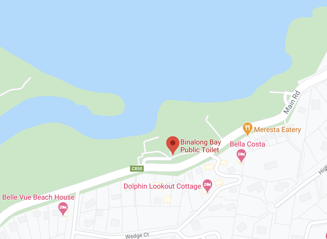
Start/Finish location is on Main Road, Binnalong Bay
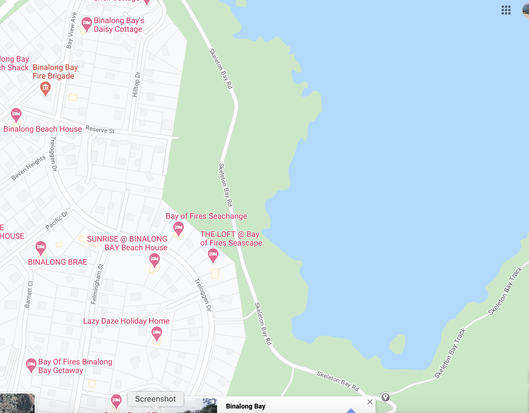
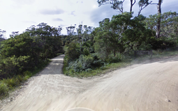
The trail head is located 1.8km from the Binalong Bay carpark and is just off Skeleton Bay Road.
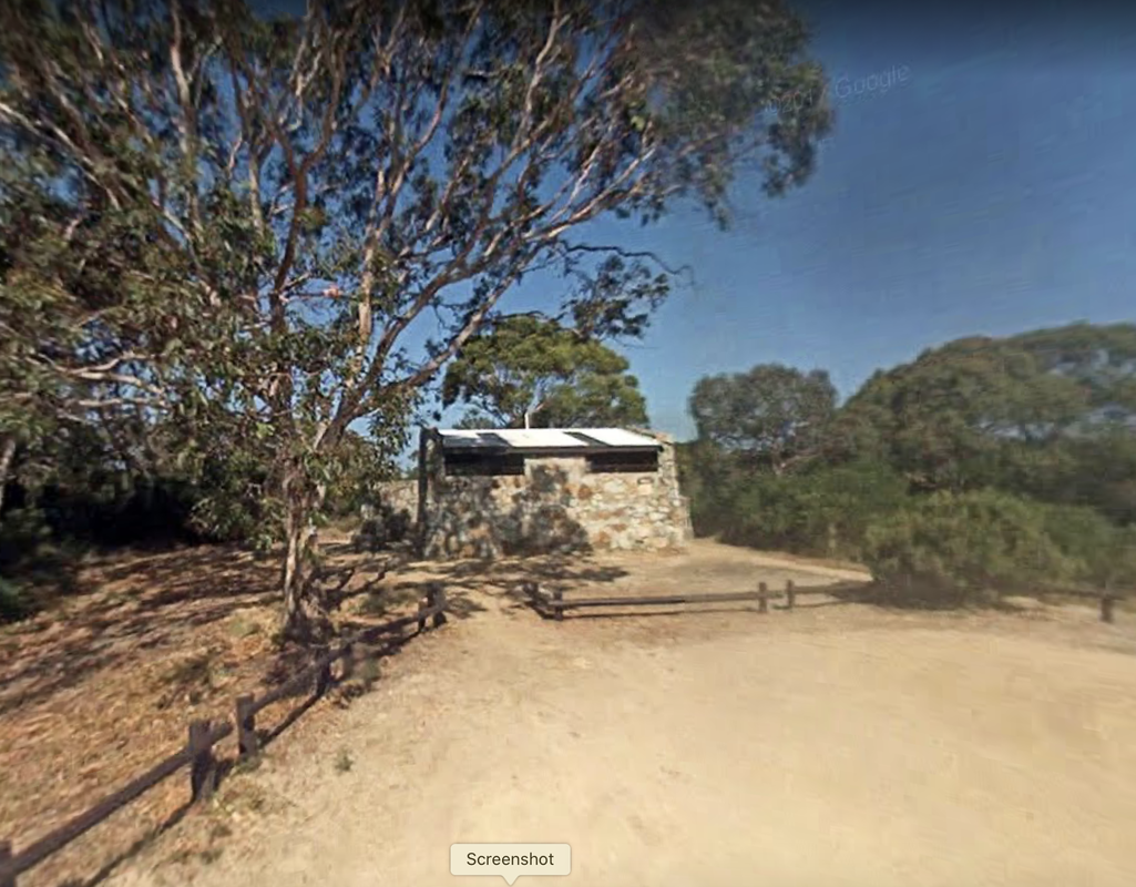
Dora Point campground amenities block
|
About larapuna - The Bay of Fires
The Bay of Fires has long fascinated my imagination: an unfettered coastline scattered with mammoth boulders of rich ochre red and steely blue granite that is lapped (sometimes violently thrashed) by azure waters. - Australian Traveller
Overview
The Bay of Fires (indigenous name: larapuna) on Tasmania’s East Coast extends from Binalong Bay in the south to Eddystone Point in the north. This unusual name was given to the area by Captain Tobias Furneaux, in 1773, when he noticed numerous fires along the coast. This led him to believe that the country was densely populated. Abundant evidence of this occupation by Aboriginal people can be seen along the coast today. Whaling was extensively carried out in the area during the 1840s which turned the waters a deep, blood red. Further to this, the coastline is covered by a vibrant red-orange, lichen-covered granite boulders. Therefore, the region really has lived up to its name, 'The Bay of Fires'.
From our route's starting point at Binalong Bay, there is a scenic view that takes in the length of the coast right up to The Gardens. This picturesque area was named by Lady Jane Franklin, the wife of Governor John Franklin, who spent some time in the region.
From our route's starting point at Binalong Bay, there is a scenic view that takes in the length of the coast right up to The Gardens. This picturesque area was named by Lady Jane Franklin, the wife of Governor John Franklin, who spent some time in the region.
Aboriginal heritage
Aboriginal bands who frequented the area called it larapuna - the meeting place for Panpe-kanner, Leener-rerter and Pinter-rairer family groups. A number of Aboriginal midden sites found in the sand dunes containing distinct concentrations of shells and strong evidence of active hunting, gathering and food preparation activities in the area. Today, these sites are significant, sacred areas to the Tasmanian Aboriginal community.
European Culture
Surveying the landscape it is easy to make the assumption that the Bay of Fires was named for the colour of the rocks I am currently standing on, but the name was actually bestowed in 1773 when Captain Tobias Furneaux, sailing aboard the HMS Adventure, noticed the fires lit by the indigenous people who existed along the coastline. Furneaux didn’t set foot on the land but he did change it forever: the naming of the Bay of Fires was one of the first imprints on the area by Europeans. Furneaux went on to name nearby Georges Bay and St Helens Point, after St Helens on the Isle of Wight. - The Australian Traveller
And then suddenly all is blue as I traverse the last leg into St Helens, the largest town in the area and my base for exploring these parts. A former hub for the whalers and sealers who plied their trade here in the early 1800s, St Helens really came of age when tin was discovered in its surrounds in the 1870s. But the tin mines closed in the early 1990s, and since then St Helens has settled into a slower pace, trading on its natural wonders in a more positive way, through tourism, oyster farming and fishing. The area is not quite sleepy, not really bustling either, but there’s something instantly likeable about it. - The Australian Traveller
The Bay of Fires and St Helens regions were home to early explorers, pastrolists, whalers, tin miners and later, fisherman. The area is richly seeped in history, from the scarred inland areas called 'the moonscape' where past tin mining forays have left eroded undulations in the white quartz sands. The small coves, once home to the whaling communities are now frequented by cray fisherman. And today, the Bay of Fires marks the conclusion of one of Tasmania's most famous mountain bike trails, a 42km descent from The Blue Tier to Swimcart Beach, just north of Binalong Bay.
Flora & Fauna
Between September and November you may see whales off the Bay of Fires Coastline.
The Bay of Fires is part of the East Coast Whale Trail. Humpback and Southern Right whales come sufficiently close to the coast to allow regular sightings.
Seals and pods of dolphins also cruise the area. On the beaches, keep a lookout for hooded plovers, sooty and pied oyster catchers, a variety of gulls and the occasional white-bellied sea eagle. On the inland bays of George's Bay you will likely see Pelican resting.
The coastal heath and dry sclerophyll forest flanking the Bay of Fires provide ideal habitat for a rich variety of native mammals. Wallabies and possums are relatively common in the area. Spotted-tail quolls and Tasmanian devils are much more elusive.
The critically endangered swift parrot can be seen occasionally in the warmer months. They return to Tasmania from Victoria and New South Wales to breed in the blue gum forests in the Bay of Fires hinterland and feed on the nectar of blue gum flowers.
We ask you to tread gently, remembering that we are visitor's to their habitats.
Help larapuna - the Bay of Fires!
There are some active volunteer groups who help to preserve & protect the Bay of Fires. We strongly encourage you to get involved!