ROCK THE CRADLE
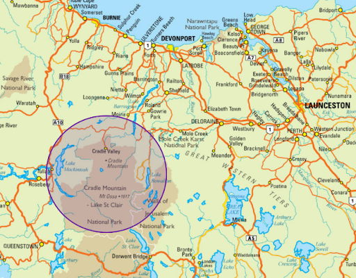
Cradle Mountain–Lake St Clair National Park, with its ancient rainforests and alpine heaths, is home to the world-famous Overland Track and iconic Cradle Mountain. Part of the Tasmanian Wilderness World Heritage Area, the park is one of the state's most special places, where ancient pines fringe glacial lakes and icy streams cascade down rugged mountains. Dramatic Cradle Mountain is the rugged jewel of the park. - Discover Tasmania
|
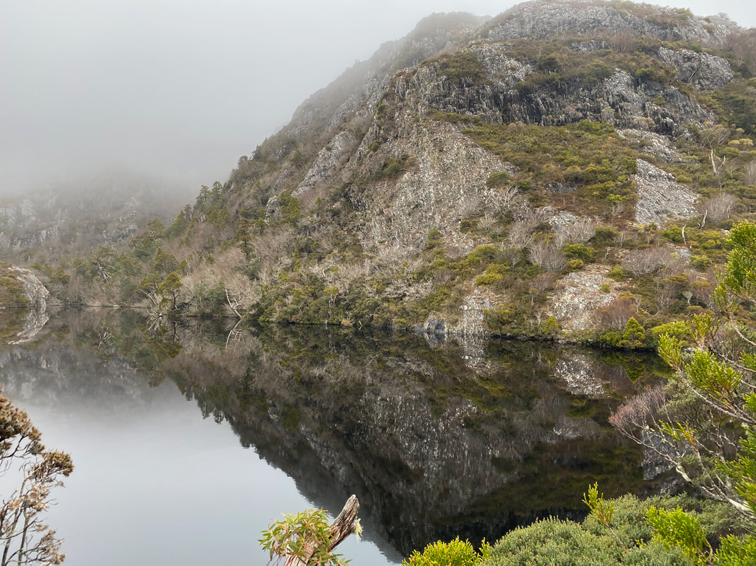
Cradle Mountain is home to some of the most diverse and outstanding landscapes in Tasmania.
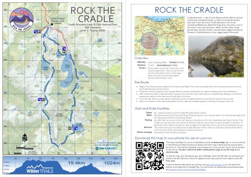
The route begins in the Ronney Creek carpark on the Dove Lake Road and is best accessible with the free shuttle bus service from the Cradle Mountain Visitor Centre. The route follows the famous Overland Track up past Marion's Lookout and kitchen hut, before heading south into the Reserve. After traversing under Cradle Mountain's western face, we then take a left-hand turn towards Lake Rodway, a trail which weaves you down into the valley and the old hiker's hut here. From the lake there is a slow, gentle climb back up the incredibly beautiful Artist's Pool to meet the Face Track where expansive views of Dove Lake await you. We return via Hanson's Peak, descending down to Dove Lake and meandering back to Ronney Creek past Lake Lila, a photographer's hotspot. |
|
Overview
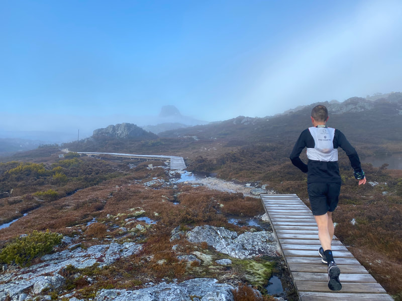
Difficulty Level 2, Playing Wilder Distance 19.4km Ascent 1024m Descent 1024m Terrain Rocky, alpine terrain with many stairs and uneven single trails. There are some short sections with safety chains. In the lower valley stretches are short boardwalk sections and smoother trails. Approx. Duration 3 - 5hrs |
The Route
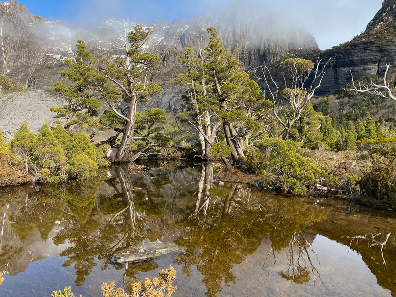
- Begin at the Ronney Creek carpark, the official start of the Overland Track, our route follows the boardwalk and then gently climbing trails to Crater Lake. On this section you will pass through a stand of ancient Pencil Pines refreshed by gushing streams and waterfalls plunging into the valley below.
- At Crater Lake you will be welcomed by the old boat house whose feet rest in the still waters of the lake. On a still, quiet day you may see a platypus here!
- Our route then continues to follow the Overland Track up steeper sections of trail past Marion's Lookout, before reaching the Cradle Plateau. Boardwalks and a wide gravel trail leads you to Kitchen Hut, a proud testament to the early walking era and now an emergency and day use shelter for visitor's to this area. There is a toilet facility located behind this hut.
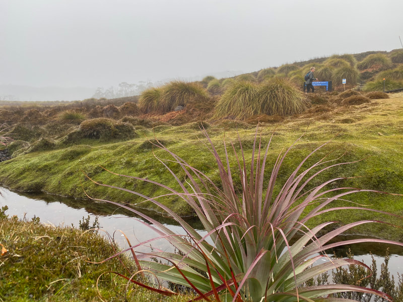
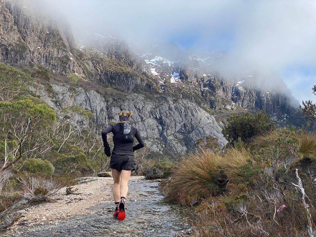
- After leaving Kitchen Hut you will reach a junction. The left-hand turn will take you to the Face Track and Cradle Mountain summit. However, TURN RIGHT and follow the main Overland Track in a southerly direction towards Waterfall Valley. This next section is quite rocky and rough underfoot. Be prepared to take your time and enjoy the expansive vistas down into Fury Gorge to the west, up to Cradle's flanks on your left and out to Barn Bluff in front of you. Furthermore, we would like to caution you if you are doing this route during the autumn, winter or Spring months. On clear, cold nights the track can be covered in black ice and be very slow going! It is also susceptible to holding snow and snow drifts during these seasons. Please check the weather forecast and be prepared for all conditions on this section of the track!
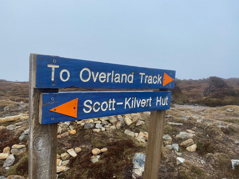
- Approximately 3km after leaving Kitchen Hut you will reach a junction with an obvious blue sign. TURN LEFT towards Lake Rodway. Whilst initially flatter as you traverse to the edge of the plateau, the track then quickly descends down stairs and steeper sections to Lake Rodway. This can be a welcome relief from the often wild and woolly conditions back up on the plateau.
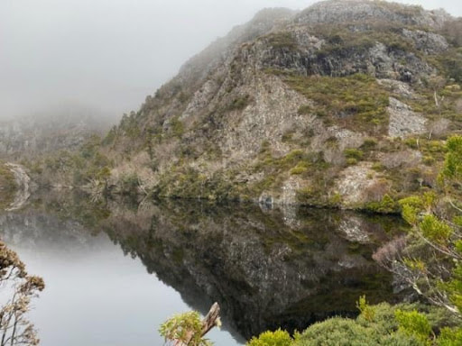
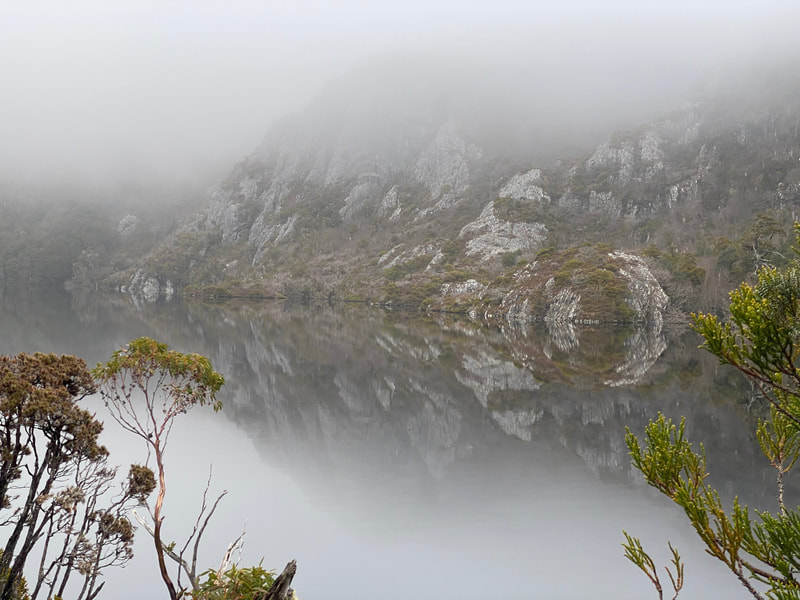
- Just before reaching Lake Rodway you will arrive at the Scott-Kilvert hiker's hut. The track is poorly signed in this section so take your time. Follow the sign towards the toilet but immediately veer left onto a non-boardwalk section of track. The track will lead you northwards away from the hut and soon have you climbing up the valley under Cradle's eastern flanks. From here you will have impressive views to the escarpment and Little Horn. A favourite place to rest on this section is at Artist's Pool where you will be rewarded with 360-degree views.
- After Artist's Pool the track climbs for a further 1km until we reach the Face Track. TURN RIGHT, at which point you may like to take a small deviation to Ranger's Hut surrounded by its family of ancient Pencil Pines. If not, continue along the Hanson's Peak Track, climbing up and over this small rise before eventually descending down to Dove Lake. You will see a turnoff to Twisted Tarns and whilst exceptionally beautiful, this detour does add on a substantial distance and climb. We recommend saving this for another day!
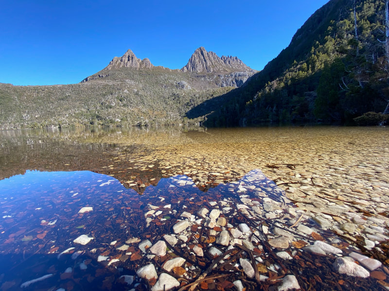
- Upon reaching the Dove Lake Track, TURN RIGHT and follow the trail past the Dove Lake Carpark and newly built visitor shelter, then up and over the hill to Lake Lilla. When you arrive at Lake Lilla we strongly recommend stopping on its northern shores where you can capture stunning views back across the lake to Cradle Mountain.
- Immediately after Lake Lilla, there is an obvious junction. Take the RIGHT-HAND FORK and continue on a rougher trail down the valley towards Ronney Creek. After crossing the footbridge keep your eyes peeled for wombats and you travel the remaining 300m to the Ronney Creek Carpark. Phew! What a rough but rewarding 20km you have just traversed... Well done!
Start and Finish Facilities
Toilets No - nearest toilets are at the Cradle Mountain Visitor Centre
Water Not that we would recommend drinking. Please bring your own. Closest water is on the trail well away from the hiking trail and from fast flowing steams.
Parking No. After 8am all access to this trail requires a shuttle bus from the Cradle Mountain Visitor Centre. Prior to 8am you can drive your own vehicle to Ronney Creek so long as there is space available in the Park. To depart you must follow a shuttle bus. We strongly encourage all participants to use the free shuttle bus service.
Services The closest services are located at the Cradle Mountain Visitor Centre or Discovery Caravan Park where there are some small cafes and basic convenience stores.
Phone coverage Very patchy Telstra & Optus reception.
|
Mapping & directions for this route
We have created 4 easy ways for you to choose from to safely and enjoyably navigate your way around this route. From a physical map to the more technology savvy, we have your safety at heart!
|
|
FREE TO DOWNLOAD
|
Digitally interactive map for use on your smartphone (FREE)
This map is available for use on a smartphone using the Avenza Maps app. It runs on Android or iOS (iPhones & iPads) and lets you display the route map in detail and see exactly where you are on it. This will be invaluable in an emergency or if you are just unsure of your location on the course. You don’t need to be within mobile phone range to use the map as it’s stored locally. To load the map, open the Avenza app, go to Add Map, select the QR code icon and point your phone at the QR code here. To get the Avenza map app for your phone, see www.avenzamaps.com or just search for Avenza on the App Store or Google Play. For instructions on loading and using Avenza maps, see www.terrainium.com.au/UsingAvenzaMaps |
Concluded the route? Don't forget to get your completion badge or lapel pin!
|
Highlights
|
About Cradle Mountain & the Cradle Mountain-Lake St Clair National Park and World Heritage Area
With thanks to the Tasmanian National Parks & Wildlife Service for access to the following information...
Overview
Iconic Cradle Mountain is a place of exceptional natural beauty in the heart of the Tasmanian Wilderness World Heritage Area. From moss-covered ancient rainforests and deep river gorges to snow-covered mountain peaks, wild alpine moorlands and glacial lakes, the park is revered for its diverse and breath-taking landscapes.
A place for all seasons, discover deep snowdrifts in winter, spectacular displays of yellows, oranges and reds across the mountain slopes in autumn as Tasmania’s deciduous Fagus turns colour, playful young joeys & hungry echidnas emerging in spring, and the fragrance of wildflowers filling the air as you dip your toe into a crystal-clear lake on a summer’s day.
Cradle Mountain is synonymous with nature, wilderness and all things pristine. Wildlife is in abundance in this spectacular national park, giving opportunity to encounter Tasmanian devils, quolls, platypus, echidna, wombats and the highly inquisitive black currawong.
Cultural heritage
It is now understood that the Tasmanian Aboriginal people have been part of this land for more than 35,000 years. Sometime during the last ice age, Aboriginal tribes crossed the land bridge spanning Bass Strait from 'mainland Australia', becoming the most southerly-dwelling humans on Earth. When the glaciers retreated and sea levels rose around 12,000 years ago, helping to carve out much of the Cradle Mountain landscape that we enjoy today, Tasmanian Aboriginals became isolated from the mainland, developing a unique and rich culture.
With regards to the aboriginal habitation in the Cradle Mountain area, their occupation of the region has been dated from the end of the last ice age, between 10,000 and 12,000 years ago. Prior to European settlement, Cradle Mountain was the territory of the Big River Tribe. Due to the nature of the inclement weather conditions, it is thought that Aboriginal people did not live in this challenging alpine environment permanently, but rather travelled to the area’s fertile, sub-alpine valleys during summer on seasonal hunting trips.
Throughout the Cradle Valley, Aboriginal sites, or living areas, have been identified through the presence of stone tools, rock shelters or caves that show evidence of human use, and quarry sites where stone was sourced for tool making. Reports from early European settlers also describe well-constructed bark huts and evidence of burning vegetation to attract prey. Today these living areas carry enormous significance to the Tasmanian Aboriginal community. For the world, they demonstrate the incredible adaptability and resilience of the individuals who where able to survive and live here in isolation during the most recent glacial period.
Cradle Mountain now sits between the Big River and Northern Tasmanian Aboriginal nations. Aboriginal Tasmanians were persecuted by the European settlers upon their arrival, and the last free Aboriginals in the area were seen just south of Cradle Mountain in 1836. The Aboriginal sites within Cradle Mountain-Lake St Clair National Park are evidence of tens of thousands of years of continuous history and connection with this land, and are wholly protected within the Tasmanian Wilderness World Heritage Area.
European Culture
This must be a national park for the people for all time. It is magnificent, and people must know about it and enjoy it. - Gustav Weindorfer
Europeans first explored, and climbed, Cradle Mountain in 1827 and 1828 with Joseph Fossey and Henry Hellyer surveying for the Van Diemen's Land Company.
Trappers worked in the area from the 1860s until the collapse of the fur trade in the 1950s, although hunting in the park was declared illegal after 1927. They established huts, including Du Cane and Pine Valley, and burned the land to encourage fresh growth and game. Scars of fire are still evident throughout Cradle Valley today, although thankfully there are still large stands of King Billy Pine remaining in the Ronney Creek & Waldheim areas.
The Cradle Valley was subject to extensive natural degredation prior to its preservation. A large expanse of King Billy pines were found by James Smith in 1863, and the area was logged until the 1910s. Smith's son continued logging the area on private (but National Park adjacent) land from 1943 to the 1972, thankfully ending after significant public protest. Cattle and sheep also grazed in Cradle Valley from 1910 to 1930. Further proposals for the area varied from large mines and railways, to farms and plantations.
However, it was the vision of Austrian-born Gustav Weindorfer and his wife Kate which ultimately led to Cradle Mountain being declared a national park. In the 1910s Gustav and Kate Weindorfer climbed Cradle Mountain. They found the land beautiful and Gustav proclaimed "This must be a national park for the people for all time. It is magnificent, and people must know about it and enjoy it".
They began campaigning for the area from Cradle Mountain to Lake St Clair to be a national park, and set up a popular chalet the next year. It was declared a scenic reserve in 1922, a wildlife reserve in 1927 and its current designation of national park from 1947. During this transition former trappers began building huts and guiding bushwalkers, including Paddy Hartnett, Weindorfer and Bob Quaile.
In 1931 fur trapper Bert Nichols blazed the Overland Track starting from Cradle Mountain and heading south to Lake St Clair. By 1935 it was consolidated and used by independent walking parties.
Cradle Mountain–Lake St Clair National Park became a part of the Tasmanian Wilderness World Heritage Area in 1982. In the last few years Cradle Mountain has seen an explosion of visitors and is challenged by the fragile juggle of preservation and visitation.
Their (Gustav & Kate's) love story unfolded in the Tasmanian wilderness a century ago. What would this pioneering pair make of Cradle Mountain now? - Kate Legge, The Australian
Flora & Fauna
Cradle Mountain's biodiversity spans ancient rainforests to alpine heaths and grasslands. You'll find ancient plants and trees such as the endemic King Billy Pine, the native deciduous beech tree, myrtle, sassafras, buttongrass, and tea tree.
The Cradle Mountain region is an area of marked geological contrasts, shaped by glacial erosion and deposition over the past two million years. The various glaciers that covered the area have left behind a variety of glacial features, including the valley of the Dove River, and numerous lakes and tarns.
Cradle Mountain comprises a diverse mosaic of vegetation communities, from rainforest to buttongrass moorlands. The area contains ancient plants of Gondwanan origins, including long-lived endemic conifers such as the King Billy pine, pencil pine and celery-top pine, as well as Tasmania's deciduous beech (fagus), which colours the hillsides each autumn.
The area's Gondwanan heritage is further revealed through the existence of species such as velvet worms, fish in the family Galaxiidae, aquatic insects and crustaceans. Other invertebrates, such as the pencil pine moth, reveal even more ancient links to the super-continent Pangea.
Cradle Mountain contains a wide range of habitats and is home to some of the world's largest carnivorous marsupials – the Tasmanian devil, spotted-tailed quoll and eastern quoll – as well as wombats, platypus and echidna.
We ask you to tread gently, remembering that we are visitor's to their habitats.
Help the Cradle Mountain & Lake St Clair National Park!
There are some active volunteer groups who help to preserve & protect the Cradle Mountain - Lake St Clair National Park. We strongly encourage you to get involved!

