Rocky Cape
|
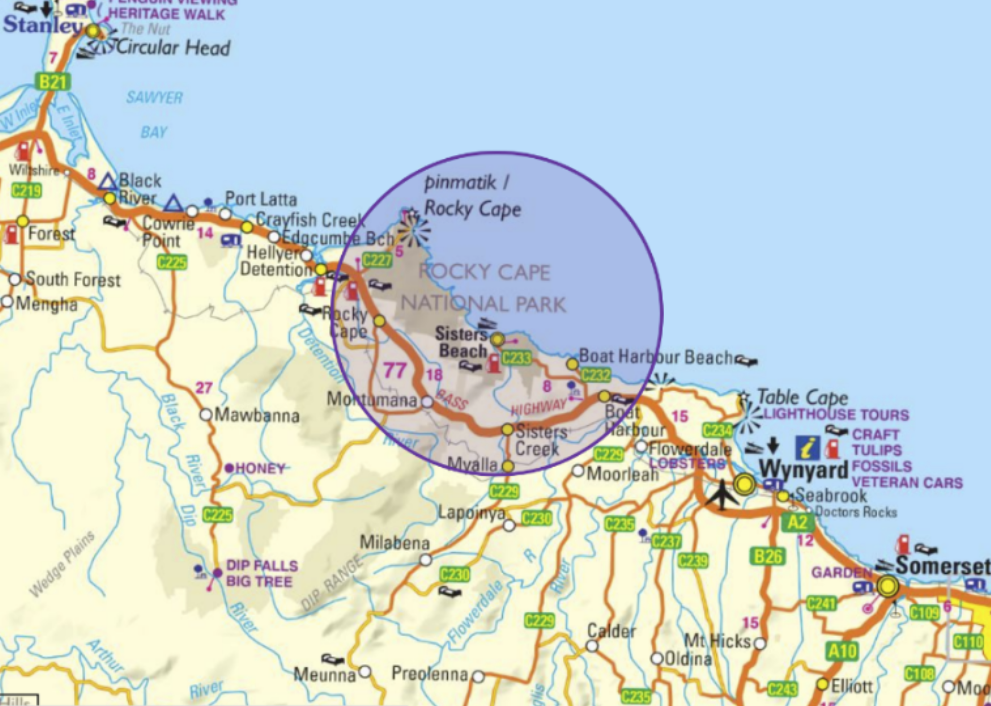
Rocky Cape National Park is a geographically stunning coastal landscape located on Tasmania’s North West Coast. It is dually named pinmatik / Rocky Cape in acknowledgement and recognition of the ongoing preservation of its Aboriginal culture and heritage.
This ancient coastline offers an extensive display of cliffs and beaches housing vast cave shelters, midden piles and powerful and dominant rock formations. The floral display along the coastal Sisters Hills is vibrant and diverse. Sightings of Wombat, Quoll, Eagles, Wallabies and Echidna are not uncommon. |
|
Overview
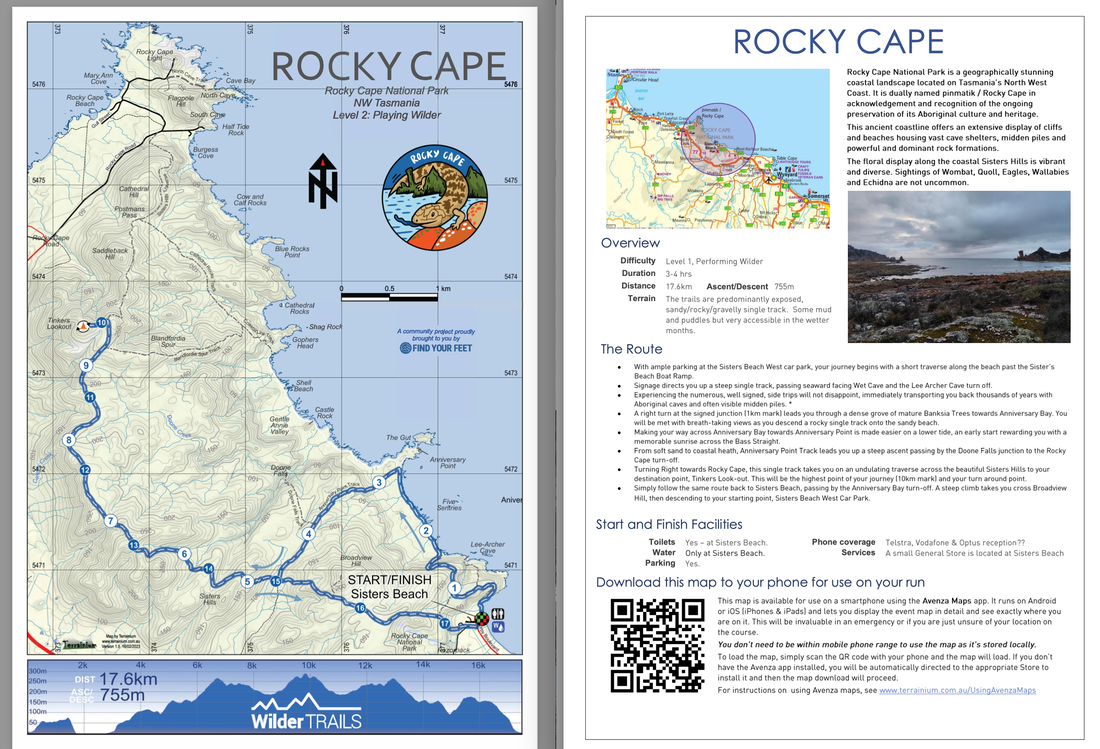
Difficulty Level 2, Playing Wilder Duration 3-4 hrs Distance 17.6km Ascent/Descent 755m Terrain The trails are predominantly exposed, sandy/rocky/gravelly single track. Some mud and puddles but very accessible in the wetter months. Start and Finish Facilities
Toilets Yes – at Sisters Beach. Phone coverage Telstra, Vodafone & Optus reception. Patchy in areas. Water Only at Sisters Beach. Services A small General Store is located at Sisters Beach Parking Yes. |
PHOTO - LUCY HAWTHORNE |
- With ample parking at the Sisters Beach West car park, your journey begins with a short traverse along the beach past the Sister’s Beach Boat Ramp.
- Signage directs you up a steep single track, passing seaward facing Wet Cave and the Lee Archer Cave turn off.
- Experiencing the numerous, well signed, side trips will not disappoint, immediately transporting you back thousands of years with Aboriginal caves and often visible midden piles. *
- A right turn at the signed junction (1km mark) leads you through a dense grove of mature Banksia Trees towards Anniversary Bay. You will be met with breath-taking views as you descend a rocky single track onto the sandy beach.
- Making your way across Anniversary Bay towards Anniversary Point is made easier on a lower tide, an early start rewarding you with a memorable sunrise across the Bass Straight.
- From soft sand to coastal heath, Anniversary Point Track leads you up a steep ascent passing by the Doone Falls junction to the Rocky Cape turn-off.
- Turning Right towards Rocky Cape, this single track takes you on an undulating traverse across the beautiful Sisters Hills to your destination point, Tinkers Look-out. This will be the highest point of your journey (10km mark) and your turn around point.
- Simply follow the same route back to Sisters Beach, passing by the Anniversary Bay turn-off. A steep climb takes you cross Broadview Hill, then descending to your starting point, Sisters Beach West Car Park.
|
Mapping & directions for this route
We have created 4 easy ways for you to choose from to safely and enjoyably navigate your way around this route. From a physical map to the more technology savvy, we have your safety at heart!
|
|
FREE TO DOWNLOAD
|
Digitally interactive map for use on your smartphone (FREE)
This map is available for use on a smartphone using the Avenza Maps app. It runs on Android or iOS (iPhones & iPads) and lets you display the route map in detail and see exactly where you are on it. This will be invaluable in an emergency or if you are just unsure of your location on the course. You don’t need to be within mobile phone range to use the map as it’s stored locally. To load the map, open the Avenza app, go to Add Map, select the QR code icon and point your phone at the QR code here. To get the Avenza map app for your phone, see www.avenzamaps.com or just search for Avenza on the App Store or Google Play. For instructions on loading and using Avenza maps, see www.terrainium.com.au/UsingAvenzaMaps |
Concluded the route? Don't forget to get your completion badge or lapel pin!

