
THE LION'S CAPE
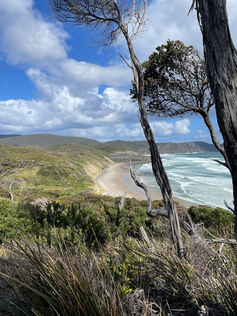
Experience a taste of the wild south... It’s a rare day when the wind isn’t howling and the surf roaring at this breath-taking place.
|
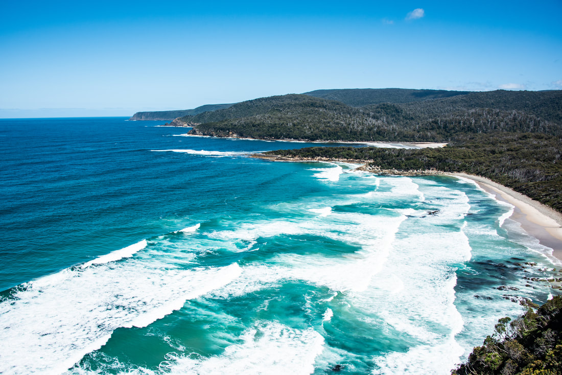
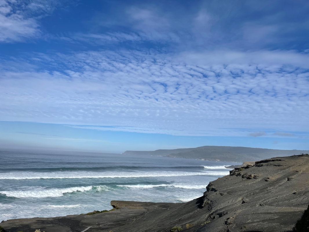
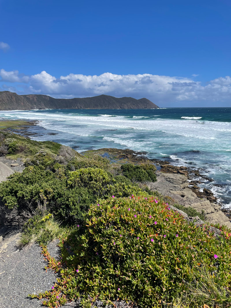
The south coast of Tasmania brews wilder waves that smother jagged rocks and vast sandy beaches. Vegetation grows abundant, dense and curved into the southerly winds that whip the region. Be prepared for your breath to be stolen by the elements... and the views!
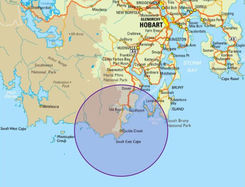
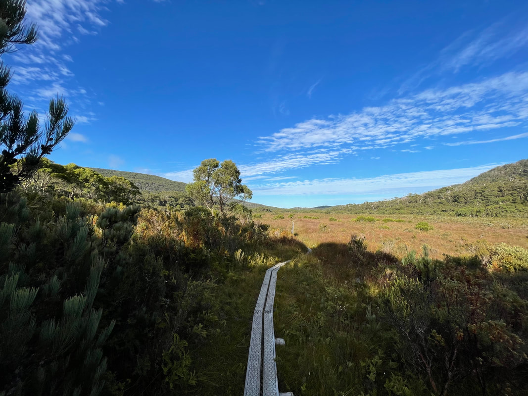
The South Coast Track is understandably one of Tasmania’s premier wilderness walks. We have targeted a more accessible and spectacular section of the trail, achievable for most individuals with some preparation. You will venture from Cockle Creek, a popular local camping spot on Australia's most southern road, heading first through forest and then across wide-open button grasslands to South Cape Bay. Here sweeping views of the windswept beach and Lion Rock await you. If you choose to, you will continue on the South Coast Track to South Cape Rivulet, a quiet retreat on this vast coastline that is continuously buffeted by the Southern Ocean. The route will meander back the same way. |
|
Overview
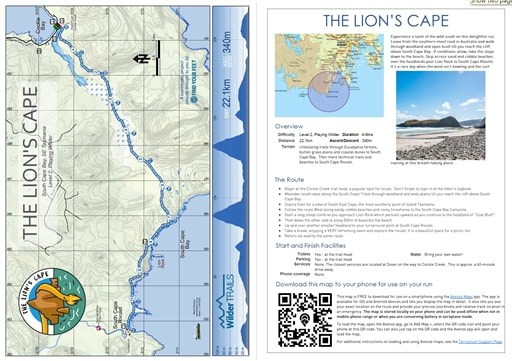
Difficulty Level 2, Playing Wilder Distance 22.1km Ascent 240m Descent 240m Terrain Undulating trails through Eucalyptus forests, button grass plains and coastal dunes to South Cape Bay. Then more technical trails and beaches to South Cape Rivulet. Approx. Duration 4 - 6hrs |
South Cape Bay
|
The Route
- Begin at the Cockle Creek trail head, a popular local swimming, fishing and camping spot for locals. Don't forget to sign-in at the hiker's logbook.
- Meander south-west along the South Coast Track towards South Cape Bay. The trail will first pass through Eucalyptus forest before opening onto wide plains where views to the western mountain ranges can be seen. Also, glance to the east for a view of South East Cape, the most southerly point of island Tasmania.
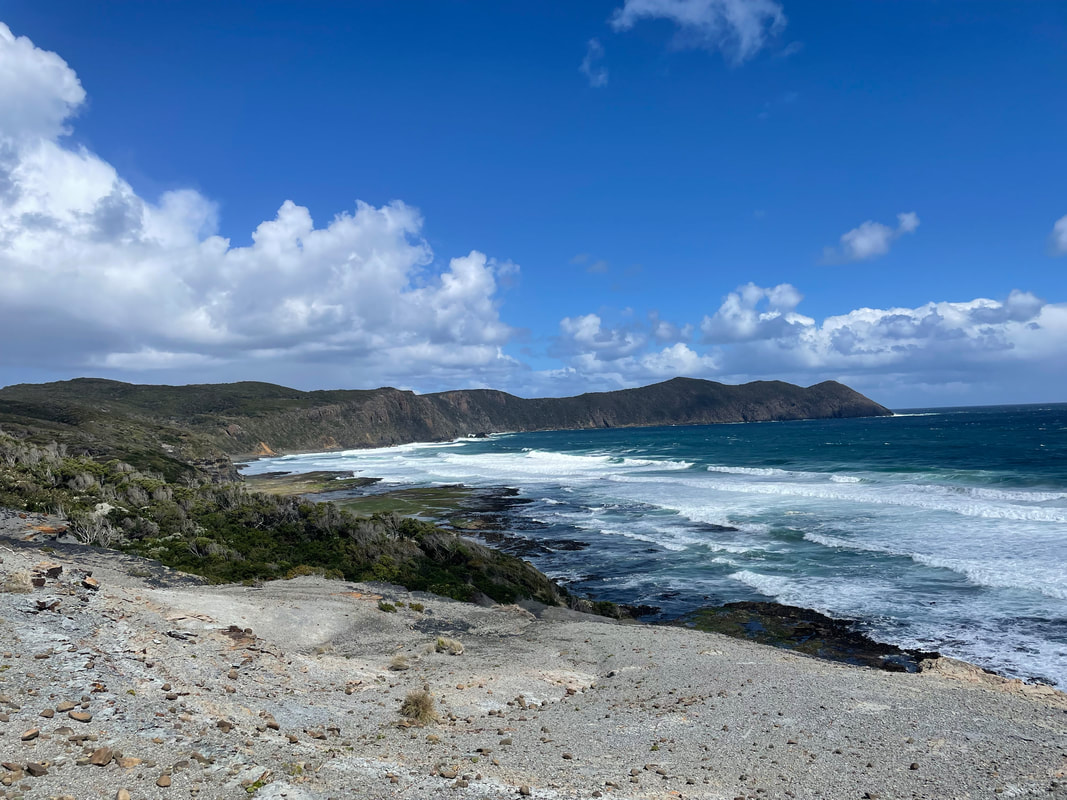
- Follow the route West along sandy cobble beaches and rocky foreshores to the South Cape Bay Campsite.
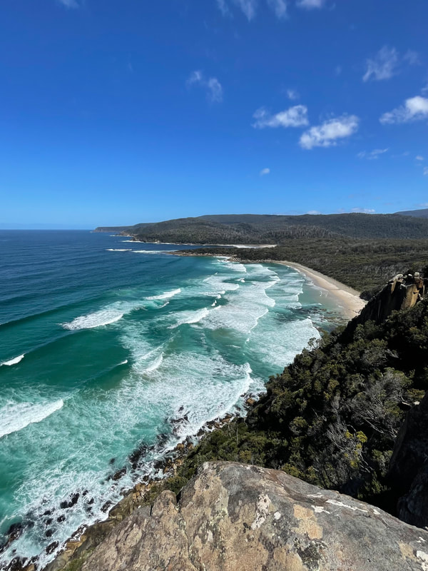
- Start a long steep climb as you approach Lion Rock which persists upward as you continue to the headland of “Coal Bluff”.
- Then down the other side to enjoy 500m of beautiful flat beach before climbing up and over another smaller headland to your turnaround point at South Cape Rivulet.
- Take a break, enjoying a VERY refreshing swim and explore the rivulet. It is a beautiful place for a picnic too!
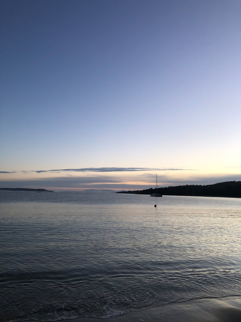
- Return home via exactly the same route. On a blue-sky day Cockle Creek's calm cove will certainly entice you for another swim!
Start and Finish Facilities
Toilets Yes - at the trail head
Water Not that we would recommend drinking. Please bring your own.
Parking Yes - at the trail head
Services The closest services are located at Dover on the drive to Cockle Creek. This is approximately 60-minutes drive.
Phone coverage None
Toilets Yes - at the trail head
Water Not that we would recommend drinking. Please bring your own.
Parking Yes - at the trail head
Services The closest services are located at Dover on the drive to Cockle Creek. This is approximately 60-minutes drive.
Phone coverage None
|
Mapping & directions for this route
We have created 4 easy ways for you to choose from to safely and enjoyably navigate your way around this route. From a physical map to the more technology savvy, we have your safety at heart!
|
Here is a sample of the mapping and directions available as a PDF download or printed waterproof versions
|

FREE TO DOWNLOAD
|
Digitally interactive map for use on your smartphone (FREE)
This map is available for use on a smartphone using the Avenza Maps app. It runs on Android or iOS (iPhones & iPads) and lets you display the route map in detail and see exactly where you are on it. This will be invaluable in an emergency or if you are just unsure of your location on the course. You don’t need to be within mobile phone range to use the map as it’s stored locally. To load the map, open the Avenza app, go to Add Map, select the QR code icon and point your phone at the QR code here. To get the Avenza map app for your phone, see www.avenzamaps.com or just search for Avenza on the App Store or Google Play. For instructions on loading and using Avenza maps, see www.terrainium.com.au/UsingAvenzaMaps |
Concluded the route? Don't forget to get your completion badge or lapel pin!
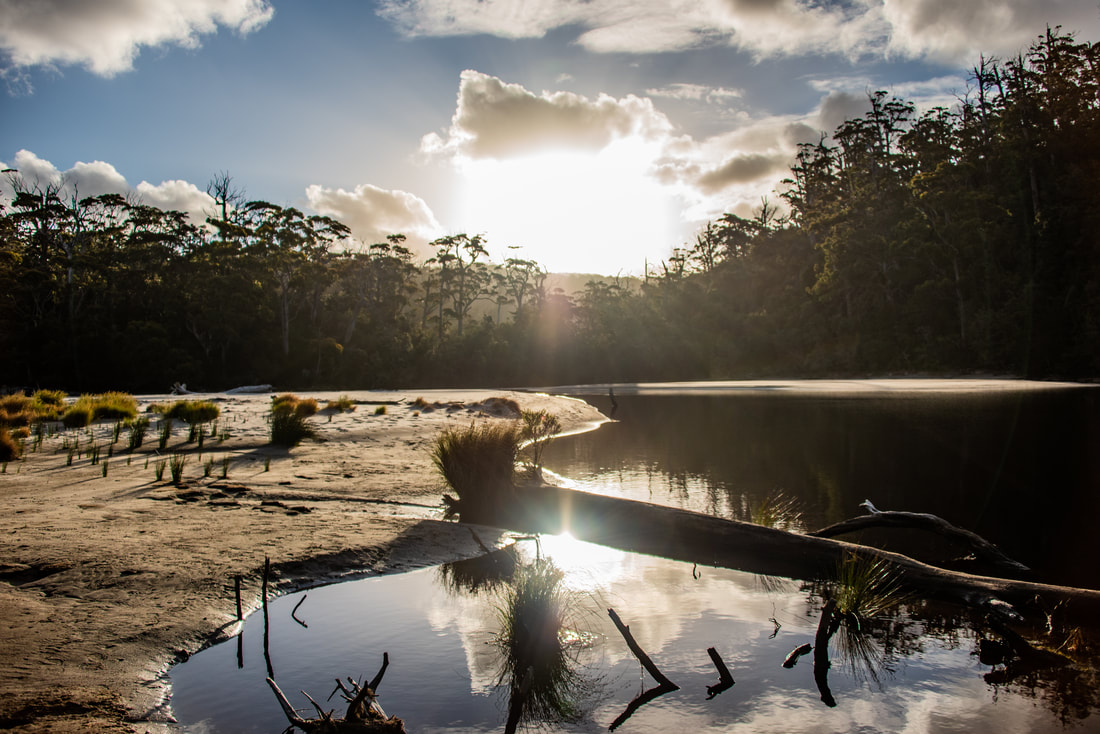
South Cape Rivulet
|
Highlights
|
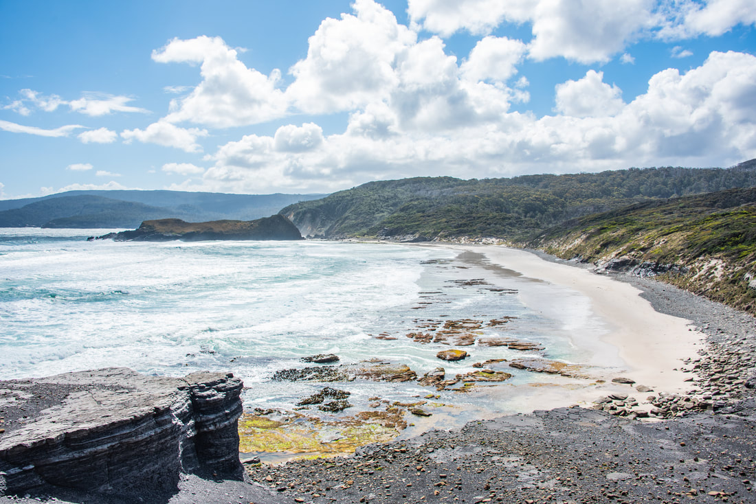
Sweeping views to Lion Rock at South Cape Bay
About the South West World Heritage Area
With thanks to the Tasmanian National Parks & Wildlife Service for access to the following information...
Overview
"A shining beacon in the dull, uniform and largely artificial world.” These are the famous words of pioneer wilderness photographer Olegas Truchanas who sadly passed away in 1972 and didn’t live to see that vision realised. But the Tasmanian Wilderness World Heritage Area, declared in 1982, surely fits his vision for Tasmania. Covering one and a half million hectares, or around one-fifth of Tasmania’s land mass, this global and national wonder protects an amazing array of natural and cultural heritage.
Most UNESCO World Heritage sites meet only one or two of the ten criteria for that status. The Tasmanian Wilderness World Heritage Area (TWWHA) meets seven out of ten criteria. Only one other place on earth—China’s Mount Taishan—meets that many criteria. The south-west has another ‘outstanding example of … ongoing geological processes’, notably the jagged Precambrian quartzite mountain ranges, including the Frankland and Arthur ranges.
Most UNESCO World Heritage sites meet only one or two of the ten criteria for that status. The Tasmanian Wilderness World Heritage Area (TWWHA) meets seven out of ten criteria. Only one other place on earth—China’s Mount Taishan—meets that many criteria. The south-west has another ‘outstanding example of … ongoing geological processes’, notably the jagged Precambrian quartzite mountain ranges, including the Frankland and Arthur ranges.
Cultural heritage
The TWWHA is a diverse Aboriginal cultural landscape in which the cultural heritage of Tasmanian Aboriginal people is preserved. For tens of thousands of years Aboriginal people lived in the coastal environments, the valleys with freshwater rivers, open button grass plains and alpine mountains.
Aboriginal people have lived in, used, managed and modified the landscape of the TWWHA for at least 35,000 years. The physical evidence of this connection is apparent today in elements such as the vegetation types and coverage within the TWWHA, which were managed and modified by targeted burning regimes implemented by Aboriginal people. Aboriginal cultural heritage sites provide further evidence of the long connection with the landscape.
Aboriginal cultural values are also evident in intangible knowledge associated with the TWWHA including story, song, dance, language, kinship, custom, ceremony and ritual. Knowledge of these intangible elements are held by Tasmanian Aboriginal people and are often associated with physical places or features within the landscape with some, such as the creation story associated with Louisa Bay and Cox Bight, presented to the public in the form of an interpretative walking trail known as the Needwonee Walk at Melaleuca, the western-most tip of the famous South Coast Track.
The TWWHA continues to be significant to today's Tasmanian Aboriginal community.
European Heritage
The South Coast Track follows ancient travelling and trading routes...
The first Europeans to visit this area were Bruni D’Entrecasteaux and crew who sailed into what is now called Recherche Bay in 1792. In the 1830s this bay became a centre for whaling, coal mining and sawmilling. Further west, in the Port Davey and Bathurst Harbour area, timber cutters were harvesting Huon pine and whales and seals were being hunted along the coast.
In the 1870s a small number of people began exploring the south-west for recreation reasons and this has grown steadily ever since.
During the 1930s the King family arrived at Melaleuca to begin tin-mining. Charles King and later his son Deny warmly welcomed bushwalkers and other visitors to this remote corner of Tasmania. Deny was a skilled bushman, keen naturalist and artist and Melaleuca was his home until his death in 1991. You can explore his story in the Deny King Heritage Museum located near the airstrip.
In 1972 the bitterly opposed damming of Lake Pedder occurred and four years later Southwest National Park was declared. The park together with a number of other reserves was accepted onto the World Heritage List as the Tasmanian Wilderness World Heritage Area in 1982.
In a world where wild places are becoming increasingly rare, Southwest National Park has a key role to play. Not only does it protect unique ecosystems for future generations, it also provides visitors with the opportunity to explore, wonder at and connect with nature.
Help the Southwest National Park!
There are some active volunteer groups who help to preserve & protect the Southwest National Park. We strongly encourage you to get involved!